
Spokane ZIP Code Directory Areas
The Spokane County ZIP and precinct map, dated March 31, 2026 and effective that month, supplies the broad Spokane County view. It labels the Spokane-serving 992xx areas along with nearby 990xx and 991xx areas. The Spokane orientations below help place a search, but they are not postal promises and they do not mark Spokane city limits. Spokane station names were not established in the official research, so the table directs readers to the Postal Service instead of guessing.
| ZIP | Areas Covered | Post Office | Notes |
|---|---|---|---|
| 99201, 99204 | Downtown, Riverside, central and central-west Spokane | Confirm with USPS | City-serving postal areas |
| 99202 | East Central and Chief Garry Park orientation | Confirm with USPS | Neighborhood and city context may cross |
| 99203, 99223 | South Hill, Manito, south Spokane and county edge | Confirm with USPS | Some 99223 addresses may sit beyond the city line |
| 99205 | West Central and Northwest orientation | Confirm with USPS | Neighborhood labels are approximate |
| 99207 | Hillyard and northeast Spokane | Confirm with USPS | Older Hillyard directories use distinct geography |
| 99208, 99218 | North Spokane, Five Mile and North Indian Trail orientation | Confirm with USPS | Check a parcel for the city boundary |
| 99217 | North Spokane postal orientation | Confirm with USPS | Not a neighborhood directory |
| 99224 | West, southwest and airport orientation | Confirm with USPS | County map does not settle city status |
| 99206, 99212, 99216 | Spokane Valley and east-county orientation | Confirm with USPS | Do not treat these as Spokane city polygons |
The Spokane postal directory therefore separates Spokane orientation from proof. No official source reviewed established a Spokane PO-box-only ZIP, unique-institution ZIP, or station assignment. For an exact Spokane delivery result, use the address-specific USPS form. For legal location, open the Spokane parcel in the county map and turn on the municipal-boundary layer.
Verify a Spokane ZIP Code
The USPS postal lookup is the right first stop for a single Spokane home or business. It standardizes the Spokane street line and returns the postal ZIP. The manifest image below shows the official lookup surface used for this task.
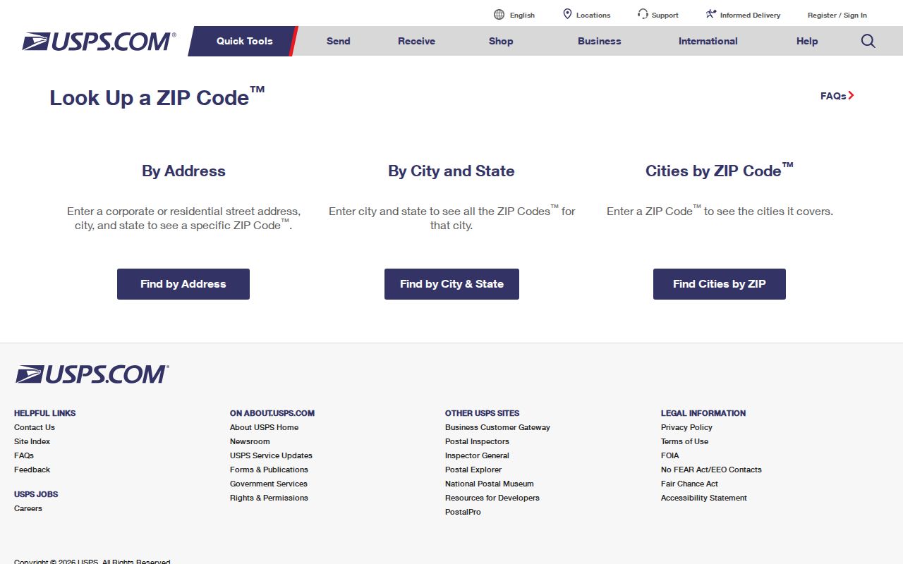
Enter the complete Spokane street address, city, and Washington as the state. Keep the standardized result exactly as returned, including Spokane directional letters and street type. That clean Spokane address can then be carried into SCOUT. A ZIP alone is too broad to prove that two people live near each other or that a parcel falls inside Spokane.
| USPS field | What to enter | What it settles |
|---|---|---|
| Street address | Corporate or residential street line | Address standardization |
| City | Mailing city on the address | Postal label, not municipal limits |
| State | Washington | State selection |
| Result | Standardized address and ZIP | Current delivery ZIP |
Spokane ZIP Code Map for 2026
The Spokane County map is unusually useful because its date is explicit. That makes it better Spokane evidence than an undated ZIP image copied from a search result. It also places Spokane precinct lines beside ZIP geography, which helps explain why election districts and postal routes should not be treated as the same thing.
Use the map for a Spokane County overview and record the effective date with any notes. Then verify the specific Spokane address through USPS. Spokane postal routes can change, and the map itself does not claim to draw the City of Spokane boundary. This timely source strengthens a postal directory without turning a county map into a resident roll.
Note: The March 2026 map includes nearby county ZIPs, but their appearance does not place them inside Spokane city.
Find Spokane Residents by ZIP
No inspected Spokane public portal offers a simple, open list of every person in a Spokane postal area. The reliable method is to use a ZIP to narrow Spokane geography and then search the Spokane record that matches the question. Spokane property records identify listed owners and taxpayers, while voter data follows separate access and use rules. Neither source proves a full household.
- Confirm the exact address through USPS and save the standardized ZIP result.
- Search the address or parcel in Spokane County SCOUT. Its visible landing field accepts a parcel number or address, not a ZIP-wide query.
- Open the GIS parcel layer and inspect its
site_zip, site city, PID, acreage, and boundary context. A public ZIP-filter control was not visible, so do not promise one. - Use VoteWA only for individual self-lookup. A wider voter extract requires the official request route and its lawful political-use certification.
Once the postal area narrows to a named road, the Spokane street directory explains the address-by-address record chain. Keep the source roles separate: a parcel card supports ownership facts, a voter record supports only the fields lawfully released, and USPS supports delivery geography.
Spokane ZIP Code Fields in GIS
The public Spokane County parcel layer exposes ZIP as a Spokane parcel attribute. It also exposes Spokane parcel number, site address, site city, acreage, and segmentation status. Those fields make the Spokane GIS service useful for checking how a parcel has been labeled, though a field value is not a list of occupants.
| Parcel field | Use in a ZIP search | Limit |
|---|---|---|
| site_zip | Shows the ZIP stored for the parcel | Does not prove city limits |
| site_address / site_city | Checks the physical address label | Not an owner or occupant field |
| PID_NUM | Links the map feature to a parcel card | Parcel identifier, not a person ID |
| acreage / geometry | Shows parcel scale and shape | Not household evidence |
| seg_status | Flags parcel segmentation status | Needs record context |
The service allows queries, pagination, distance searches, and GeoJSON output, with a maximum record count of 2,000. Ordinary readers can instead use the visual map. In either route, move from the parcel identifier to SCOUT for the current public card.
Spokane Records Beyond ZIP
Spokane portal filters do not line up neatly with postal geography. The Spokane city permit map accepts address, district, neighborhood, status, date, and keyword, but the inspected filter list did not show ZIP. Spokane SCOUT accepts parcel or address. VoteWA is not a public postal-area browser. The Spokane County election form offers full-county or single-district requests, not a simple ZIP selection.
When a portal lacks a ZIP control, use the custodian's documented channel. Spokane County Elections can provide a lawful extract by certified request, subject to permitted political use, while the parcel map can be browsed address by address. For an older or unclear address, the Spokane Public Library and historical directory collections provide the era-based fallback. Do not convert postal geography into a promised bulk resident list.
Spokane Directory Geography Shifts
Postal codes are a poor key for records made before modern ZIP assignments. Spokane's historical directory geography includes separate Hillyard, suburban, and Spokane Valley runs. A north-Spokane address that fails in a volume labeled Spokane may appear in a Hillyard run, while an east-county address may retain a suburb label in an older source.
This geographic split is a useful family-history clue. Preserve the city or district label printed in the source, plus its year, before comparing it with today's postal result. Current USPS spelling should not be written backward into an old citation. The Spokane directory-book collections cover the separate runs and access routes in depth.
Spokane ZIP Code and City Boundaries
A Spokane mailing label does not establish that a parcel lies inside the city. Postal routes can cover unincorporated pockets and nearby municipalities. In the other direction, city neighborhoods can span more than one ZIP. Confirm delivery geography through USPS, then turn on the municipal-boundary and urban-growth-area layers in SCOUT for jurisdiction.
- ZIP and ZIP+4
- A ZIP identifies a delivery area. ZIP+4 adds a smaller delivery segment for a building, block, or group of boxes.
- PO-box ZIP
- A ZIP assigned mainly to post-office boxes. No Spokane example was confirmed in the reviewed official sources.
- Unique ZIP
- A code assigned to one high-volume organization. No local assignment should be claimed without USPS confirmation.
- Carrier route
- A mail-delivery route within postal geography. It is not the same as a parcel, precinct, or city boundary.
The assessor does not assign addresses. County research directs confirmed changes to Building and Planning or Public Safety, while the Auditor holds deeds, plats, and easements. For historical uncertainty, compare city directories, Sanborn sheets, permits, and the exact plat instead of assuming one citywide renumbering date.
Boundary check. Treat postal ZIP, municipal boundary, neighborhood council, precinct, and parcel lines as five different layers.